- XML
- Sitemap
- Email: guizhoutravel@hotmail.com
- ABOUT US
- CONTACT US


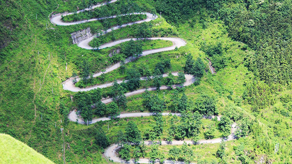
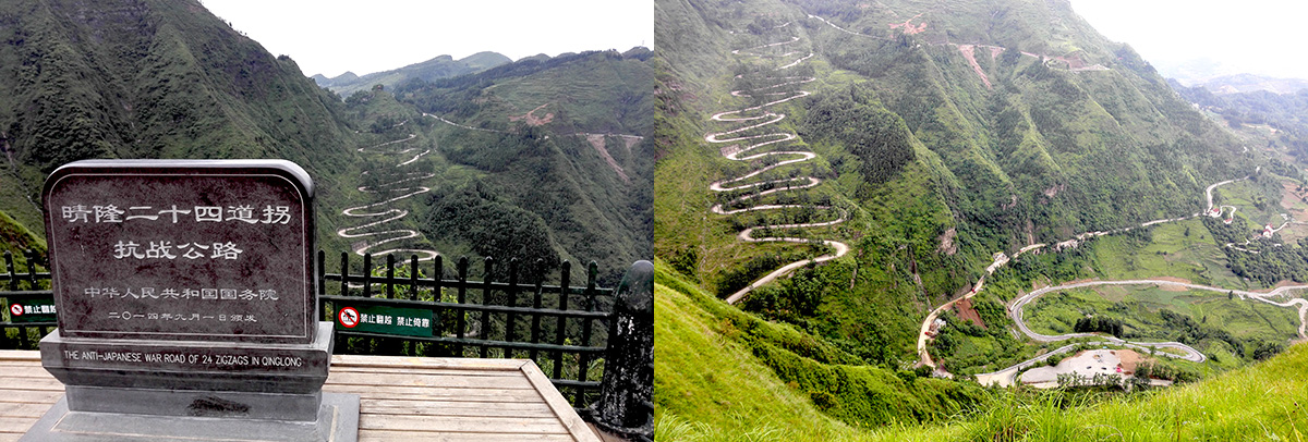
A 24 switchbacks Road in Qinglong
Description

Qinglong, China — From a distance, the sharp bends look dizzying.
With 24 switchbacks -- count them -- the spectacular road twists and turns for two and a half miles up a remote mountainside in southwestern China. No longer in active use save for a handful of tourists and the occasional local on a motorbike, today the road stands quiet. But it once must have felt like a hair-pinned super highway.
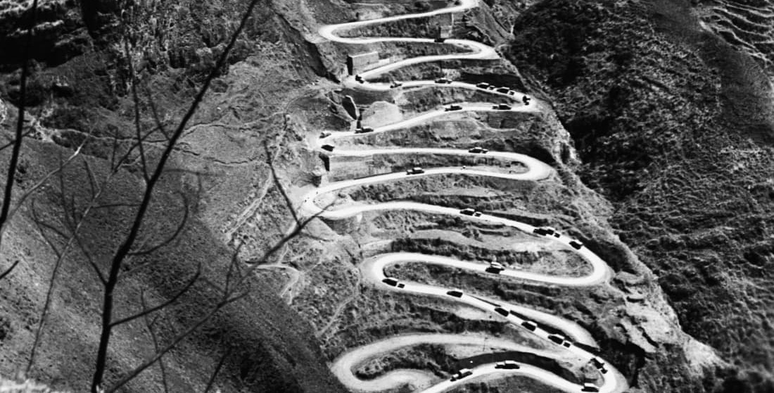
During World War II, convoys of fully loaded US GMC military trucks snaked up the road transporting 15,000 tons of supplies each month to China‘s wartime capital Chongqing.
In the opposite direction, it carried people fleeing Japanese troops.
A black-and-white picture of the road appeared in US magazines like Life and it has since come to symbolize Chinese and US cooperation against Japanese occupation -- an often forgotten chapter of that era.


‘Lost‘
But, after the end of the war and the Communist victory in China, the location of the road in the striking picture was lost to historians for decades. A new road with fewer switchbacks opened in 1954 displacing the corkscrew route from the few maps that existed.
Many thought it was in northern Myanmar or the neighboring province of Yunnan -- part of the wartime Burma Road that brought supplies from India to China as Japanese troops controlled the eastern seaboard.
In China, it‘s known as the Stillwell Road after the US General Joseph Stillwell. Ge Shuya, a Chinese historian based in Yunnan, located the road near the town of Qinglong in 1995.
Of course, it‘s remained a useful shortcut for locals like Yang Xuekun, a 75-year-old farmer whose simple, one-story home lies near the top.
CONTACT US
-
- Mobile: +86 13595521025
- Email: guizhoutravel@hotmail.com
- ADD: No.53, East Yingpan Road, Kaili city, Guizhou province, China


 Bill ZHANG